Urban heritage · Olinda / Amaro Branco
Olinda Lighthouse
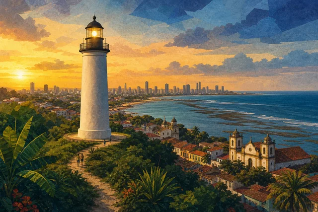

A lighthouse with Brazil's first lift
The Olinda lighthouse is a working navigation light on Morro Serapião, inaugurated on 7 September 1941. In a town of baroque and colonial houses it is another twentieth-century technical landmark standing beside sixteenth-century churches.
The tower is reinforced concrete, forty-two metres tall, painted in horizontal white and black bands, the daytime marking by which the light is identified from the sea.
Inside a small lift was installed to reach the lantern, the first fitted in a lighthouse in Brazil, carrying one person at a time.
The present lighthouse replaced an earlier one built on Fortim Montenegro and first lit in 1872, so navigation has been served on this coast for more than a century and a half.
Come for the combination of engineering and view, because the lighthouse stands high and the approach opens the coastal panorama.
A practical frame: the object is small and its meaning comes from how it sits in the town rather than from size. Olinda is a rare case where ordinary infrastructure and utilitarian buildings survived alongside the churches, and that completeness is what sustains the World Heritage title.
1872 and 1941
The first lighthouse on this stretch was built on Fortim Montenegro and lit in 1872, in the period when the Brazilian coast was being systematically equipped with navigation marks.
The present tower was raised on Morro Serapião and inaugurated on 7 September 1941, a civic date evidently chosen on purpose.
Reinforced concrete in 1941 marks the era: Brazilian engineering already handled the material confidently, and the lighthouse belongs to the same technical wave as Recife's modernist works.
The lift inside the tower was the first of its kind in a Brazilian lighthouse, a rare case of a technical detail recorded as a national first.
Keep both dates: 1872 for the beginning of the function and 1941 for the birth of the present structure. Note that dates of construction, consecration and completion often diverge in Brazil, and official sources may give different years for the same property.
Structure and marking
The forty-two-metre tower is reinforced concrete, designed for continuous work in a marine climate where salt and humidity attack metal first.
The horizontal white and black bands are not decoration but daytime marking: by the combination of colours navigators identify each lighthouse in daylight, when the light itself is invisible.
A one-person lift answers a practical need, because the keeper must reach the lantern daily and forty metres of stairs wear people out faster than structures.
The lantern and optics belong to the operational part, so access to them is restricted and depends on Navy rules.
There is no display: this is a working navigation aid.
Remember the climate: humidity, salt and heavy rain degrade materials faster than in temperate zones, so the condition of anything here results from continuous care.
How to look closely
Read the proportions of the tower from the base, because forty-two metres of concrete in 1941 was an engineering challenge and the slenderness is the result of calculation rather than style.
Notice the banded paint and think about its function, since it is a language read from the sea and every lighthouse on the coast has its own combination.
Consider the hilltop siting, because a lighthouse goes where it is seen from farthest away, and the choice of Serapião answers the geometry of the coast.
Look at the panorama: from here you see Olinda, the coastline towards Recife and, on the horizon, ships heading for the port.
And remember the equipment is operational, so interior access may be closed. Watch the limits of intervention: where restoration stopped, what was left as found and what was deliberately not rebuilt for lack of documentary evidence.
Morro Serapião and the shore
The lighthouse stands on a hill away from the main historic-centre circuit, and the approach is part of the experience, because the climb opens views the ladeiras do not offer.
Around it are homes, without tourist trade or cafés, so the visit is organised on your own.
Below lie Olinda's beaches, and the route works well descending to the water afterwards.
Allow for the terrain, because the climb is felt and shade is scarce.
In the evening the area is quiet, so arrange the return in advance.
Note that distances deceive because of the terrain, and a route works better organised by altitude than by metres.
Navigation, service and access
Lighthouses in Brazil fall under the Navy, and that defines access: the object is operational first, while the tourist function is secondary and can be restricted at any time.
It is worth remembering that nineteenth and twentieth-century navigation infrastructure was built for export, because lighthouses served ships carrying sugar and cotton, and their geography matches that of the ports.
The keeper's profession is disappearing, since automation removed the need for a permanent presence and towers increasingly work unmanned.
Finally, maintaining concrete in a marine climate demands constant investment, and the condition of the lighthouse depends on the Navy's budget rather than the city's.
Looking at it as a working tool rather than a monument is the honest approach. Remember that World Heritage status brings attention and funding but also raises the cost of living for permanent residents.
Planning the visit
Confirm in advance whether visiting is open, because the lighthouse is operational and access depends on the responsible service rather than a tourist schedule.
Allow thirty to forty minutes including the climb and the surroundings.
The best moments are morning and late afternoon, because at midday the climb is hard and the panorama loses contrast.
Combine it with a walk along Olinda's beaches or with the descent into the historic centre.
Bring water, since there is no infrastructure on site.
Build a day of three or four stops with pauses, because trying to see more ends in fatigue.
Getting there and access
The lighthouse sits on Morro Serapião in Olinda, about seven kilometres from central Recife. A taxi is the most practical option, because the climb is steep and bus routes run lower down.
The ground slopes, the surface is uneven and accessibility for visitors with reduced mobility is limited.
The internal lift takes one person and belongs to the operational part, so it should not be counted as a means of access.
There is little shade on the way and in the heat the climb tires you.
Arrange return transport in advance, because finding a car here is harder than in the centre. Plan your return in advance, because transport is harder to find in the historic part after dark.
Where to go next
The nearest continuation is Olinda's beaches and seafront just below.
In the historic centre the Alto da Sé with its cathedral and museums awaits, along with convents and markets.
If the technical line interests you, add the 1934 water tower, because two twentieth-century engineering works show how Olinda solved water and navigation.
For contrast, go to old Recife, where the port appears close up.
And keep sunset for the Alto da Sé.
Olinda repays two short days more than one long one, because the town is small and dense.
Verified facts
Every fact below is linked to this profile’s source codes.
- Location
- Amaro Branco · Olinda OLINDA_MON
- Listed address
- Morro do Serapião OLINDA_MON
- Documented focus
- Vertical landmark of coastal landscape; The current lighthouse was opened in 1941 on Morro do Serapião. OLINDA_MON
- Evidence basis
- Identity, location and cultural relevance are supported by primary evidence. OLINDA_MON
Original Meu Recife editorial copy based only on this profile's source codes. It does not reproduce third-party text in full or turn a community-guide opinion into fact.
Before visiting
The lighthouse is operational and under Navy responsibility, so interior access depends on the service rather than a tourist schedule: confirm the possibility of visiting in advance. The climb to Morro Serapião is steep, shade is scarce and there is no infrastructure on site, so bring water.
- Reference address
- Morro do Serapião, Amaro Branco, Olinda — PE
- Urban heritage
- 30–90 min
- What can change
- Hours, tickets, accessibility and temporary closures can change. Confirm with the official source before visiting.
Getting there
Coordinates cross-checked against multiple mapping sources
- Reference address
- Morro do Serapião
- District and city
- Amaro Branco · Olinda, PE
- Verified coordinates
-8.011242, -34.847215