Urban heritage · Recife / Bairro do Recife / Santo Antônio
Maurício de Nassau Bridge

A bridge as urban stitching
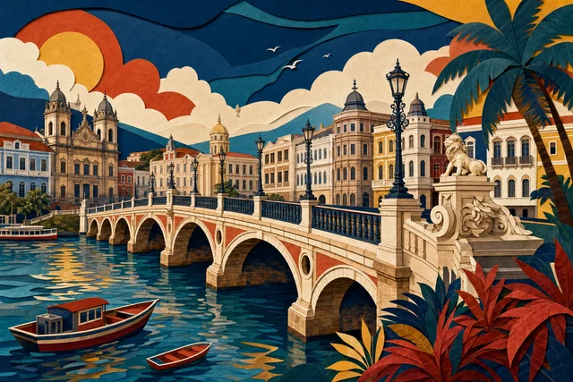
The Maurício de Nassau bridge is one of the oldest and most symbolic crossings in Recife: it links the Recife island district to Santo Antônio and originates in the colonial period, among the first urban connections built here across the water. In a city of islands, river arms and bridges that is not a detail but a foundation, because before the crossings the parts of Recife lived almost separately, and each new bridge changed the geography of daily life. Today it remains a working route for pedestrians and vehicles and at the same time one of the best viewpoints in the centre. Come to it not as a monument but as the place where the city's principle is visible. For a newcomer it is also the simplest way to grasp the layout of the centre without a map: two banks, the water between them and the sequence of bridges form a clear scheme in a single walk.
From colonial crossing to working road
The bridge's origin goes back to the colonial period, when the port island had to be linked to the neighbouring bank, and since then this crossing has counted among the main urban connections. Like almost every bridge in the delta, the structure changed over the centuries, so today's work should be read as the continuation of a historical line rather than a preserved eighteenth-century object. What endures is the crossing point, which fixed the direction of the street network on both sides. The streets of old Recife and Santo Antônio organised themselves around it, and much of the pedestrian flow between the old port and the business centre still passes here. Remember that the name attached itself to the crossing and survived changes of structure, which is why conversation tends to mix the crossing point with a specific bridge.
What to observe on the crossing
What matters here is not the structure but what it reveals. From the middle of the span several layers of the city appear at once: the port buildings of old Recife, the administrative and commercial façades of Santo Antônio, the water with its tidal rhythm, and the other bridges lined along the channel. Note the scale, because the span is short and the banks are close, which explains why the city could stitch its parts together early. The second theme is movement, with pedestrians, cyclists and vehicles sharing the crossing, proof that this is living infrastructure. The third is the view in late afternoon. The bridge also works as a viewpoint for photographs, with a clear line to the port buildings, the business district and the vessels on the water.
How to look closely
Cross in both directions and compare the banks: on the old Recife side you see the former port with warehouses and offices; on the Santo Antônio side, dense commercial fabric with churches and squares. Watch the water beneath, because the tide changes its level and colour, and the current shows how the estuary works. Look for the neighbouring bridges and try to order them mentally, an exercise that reveals the logic of the city. Watch the people, since the bridge is an everyday route and its density at different hours indicates the rhythm of the centre. And stop in the middle of the span for at least a minute.
The two banks
On one side lies old Recife, with Marco Zero, Paço do Frevo, Torre Malakoff and the synagogue on Rua do Bom Jesus; on the other, Santo Antônio, with Praça da República, the Teatro de Santa Isabel and the commercial streets. The bridge joins those two worlds within a few minutes on foot, and that is its practical value for a route, because it turns two separate walks into one. By day the flow is heavy, at night calmer, and during Carnival and big events circulation changes with the closures. Consider the climate, since the crossing is open and has no shade at all.
Infrastructure and memory
Bridges in Recife carry a double biography. On one hand they are the technology that allowed the city to form as a unit; on the other they are the infrastructure of a colonial port through which sugar, goods and enslaved people passed, and easy connection served that economy first. The name refers to the period of Dutch administration, and names like that always carry an interpretation of history worth noticing. There is also the present layer: the central bridges operate at their limit, require constant maintenance and periodic works, and any closure immediately alters life in two districts. Here the monument is inseparable from daily function.
Planning the visit
The bridge needs no time of its own, since it fits naturally into the route between old Recife and Santo Antônio. Allow ten to fifteen minutes for an unhurried crossing with a pause in the middle. The best moments are early morning and the hour before sunset, with less heat and better light. If you are building a day in the centre, use the bridge as the hinge: first the old port with its museums, then the theatre and the square. On Carnival days and during large events check the circulation plan, because sections may be closed. And keep your phone ready. Crossing twice, there and back, repays the effort, because the views in the two directions differ more than you expect.
Getting there and access
The bridge sits at the heart of the centre and links old Recife with Santo Antônio; the simplest way to orient yourself is by Marco Zero on one side and Praça da República on the other. Pedestrian crossing is permanent and free. The surface is level, but the pavements are narrow and traffic is heavy, so with a wheelchair, a pushchair or children keep to the inner side and choose quieter hours. There is no shade and midday is hot, while after rain the surface becomes slippery. In the evening the crossing stays busy longer than the streets around it.
Where to go next
On the eastern side the old-Recife route begins: Marco Zero, Paço do Frevo, Torre Malakoff, the Kahal Zur Israel Synagogue and Cais do Sertão. On the western side lies Santo Antônio, with Praça da República, the Teatro de Santa Isabel and the shopping streets, and beyond it São José with Pátio de São Pedro and the market. A good one-day route is organised around this crossing: morning in the old port, the bridge, afternoon in the theatrical and commercial centre. If you want more water, go down to the Marco Zero waterfront or follow Rua da Aurora to another bridge.
Verified facts
Every fact below is linked to this profile’s source codes.
- Location
- Old Recife / Santo Antônio · Recife REC_TOUR_DATA
- Listed address
- Ponte Maurício de Nassau REC_TOUR_DATA
- Documented focus
- Historic crossing along the axis of one of the first great bridges of the Dutch period, today a central element of the river landscape. REC_TOUR_DATA
- Evidence basis
- Identity, location and cultural relevance are supported by primary evidence. REC_TOUR_DATA
Original Meu Recife editorial copy based only on this profile's source codes. It does not reproduce third-party text in full or turn a community-guide opinion into fact.
Before visiting
The crossing is permanent and free and needs no time of its own: allow ten to fifteen minutes to walk it slowly with a pause in the middle. There is no shade, midday is hot and the surface is slippery after rain. On Carnival days and during large events check the circulation plan, since sections may be closed.
- Reference address
- Ponte Maurício de Nassau, Bairro do Recife / Santo Antônio, Recife — PE
- Urban heritage
- 30–90 min
- What can change
- Hours, tickets, accessibility and temporary closures can change. Confirm with the official source before visiting.
Getting there
Coordinates published by an institutional source
- Reference address
- Ponte Maurício de Nassau
- District and city
- Bairro do Recife / Santo Antônio · Recife, PE
- Verified coordinates
-8.063957, -34.875660