Skip to content
MEU RECIFERECIFE · PERNAMBUCO
The city portal for Recife and PernambucoNEWS · EVENTS · SERVICES
Cultural atlas

Urban heritage · Recife / Bairro do Recife

Bom Jesus Street
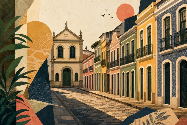
A street of historic houses tied to Jewish presence, port trade and the changing urban fabric of Recife Antigo.
2 sources and traceabilityVerified 2026-07-28
01

A street that changed its name and its trade

Rua do Bom Jesus is the best-known and most visited street in old Recife, recognisable by its coloured houses and by the density of cultural institutions along a short stretch. Within a few hundred metres sit museums, cultural centres, bars and events that keep the district moving all year.

But the essential thing is not the façades, it is the biography. In the Dutch period of the seventeenth century the street was called Rua dos Judeus, the Street of the Jews, and it was here, at numbers 197 and 203, that the first synagogue in the Americas operated. The change of name is not cosmetic: it follows the political rupture of 1654.

So read the street as a document: it shows how the city welcomed, expelled and welcomed communities again, and how the commercial function of a port quarter always outweighed ideology.

Today a tourist layer has been added, paying for the restoration of façades while changing who walks here.

02

Three eras of one street

The first era is Dutch, when the block was the commercial heart of the colony and the Jewish community lived and worked beside the quays. A rare case in the Americas of open religious life, lasting exactly as long as Dutch rule.

The second is Portuguese and imperial, with the community gone, the name changed and the street reduced to an ordinary commercial address. Centuries of trade erased almost everything, and the remains reappeared only in excavations at the end of the twentieth century.

The third is contemporary, with memory recovered, the memorial opened in 2002 and the block turned into a cultural and evening district. Restored façades made the street a recognisable image of Recife.

Holding the three layers together explains why one street looks festive and tells a hard story.

03

What is here

The base is a continuous run of historic façades painted in different colours, on narrow plots typical of port development. It is the rhythm of that terrace, rather than any single building, that makes the street what it is.

Along it stand museums and cultural centres, among them the Kahal Zur Israel memorial at numbers 197 and 203, together with bars, restaurants and venues that work in the evening. This combination of daytime culture and night-time hospitality sets the rhythm of the block.

Through the year the street becomes a stage for events, from carnival to music, and on those days traffic is closed and the crowd grows sharply.

There is no permanent display: the content is the façades, the institutions and what happens between the houses.

04

How to look closely

Start with the façades but read structure rather than colour: plot widths, window rhythm and floor heights show commercial development, with a shop below and dwelling above, not a ceremonial street.

Find numbers 197 and 203, because behind them lies the memorial of the first synagogue in the Americas, and knowing that changes how the whole street reads.

Notice where historic fabric ends and restoration begins, since much of the block has been rebuilt and telling them apart is part of the pleasure.

And see the street twice, by day and by night, because they are literally two different places.

05

Old Recife around it

The street runs through the heart of the old town, minutes from Marco Zero, from Praça do Arsenal with Torre Malakoff, and from Paço do Frevo. Practically every cultural route in the district passes along or beside it.

On one side lie the port and the water; on the other, a dense grid of streets with offices and warehouses, some converted into venues and restaurants. That context explains why the street was never quiet.

In the evening it concentrates the district's nightlife, worth considering when planning, because people come for history and dinner at the same time.

For a route it works as an axis: everything nearby radiates from it and returns to it.

06

Tolerance with an expiry date

A handsome street tells an uncomfortable story. The religious freedom that let a community live openly existed only in the Dutch period and ended in 1654, and the remains of the synagogue were later destroyed deliberately.

The second layer is economic: the block lived on the port trade of a colonial economy, including the trafficking of enslaved people, and the elegant façades were raised on that money.

The third is present-day. Conversion into a cultural and tourist showcase raises rents and changes who lives and works here, and the festive function does not answer whose street this is on ordinary days.

None of that is a reason to avoid it, only to look more carefully.

07

Planning the visit

Allow at least an hour even without entering the institutions, because walking both sides with stops takes that long by itself.

The best combination is a morning visit to the synagogue memorial and a return in the evening for dinner, which shows both regimes of the block.

Check beforehand whether a major event falls on your day, because during carnival and festivals the street is closed and becomes a stage, interesting in itself but impossible for quiet looking.

Wear stable shoes, since the paving is old and slippery after rain.

08

Getting there and access

The reference is Rua do Bom Jesus, old Recife, CEP 50030-170. The street is open around the clock and lies five to seven minutes on foot from Marco Zero; buses serve the district and by car you should expect nearby paid car parks.

On event days the street is largely pedestrian, but on ordinary days vehicles pass and the pavements are narrow. For wheelchair users the main obstacle is uneven old paving and steps at the entrances of historic buildings.

Accessibility at each institution has to be confirmed separately, because there is no single answer for the whole street.

In the evening it is busy and well lit, but late at night the block empties faster than expected.

09

Where to go next

From the street itself, step into the Kahal Zur Israel memorial and then continue to Praça do Arsenal, with Torre Malakoff and Paço do Frevo two or three minutes away.

Further on lie Marco Zero, with its view of the water and the crossing to the Brennand Sculpture Park, and in the other direction Cais do Sertão.

For contrast, climb into Santo Antônio to Praça da República and the Teatro de Santa Isabel, because the difference between a port trading street and a ceremonial ensemble of power is immediately visible.

And to close the evening, simply come back here.

10

Verified facts

Every fact below is linked to this profile’s source codes.

Location
Old Recife · Recife
REC_1DAY · REC_MEMORY
Listed address
Rua do Bom Jesus
REC_1DAY · REC_MEMORY
Documented focus
A street of historic houses tied to Jewish presence, port trade and the changing urban fabric of Recife Antigo.
REC_1DAY · REC_MEMORY
Evidence basis
Identity, location and cultural relevance are supported by primary evidence.
REC_1DAY · REC_MEMORY

Original Meu Recife editorial copy based only on this profile's source codes. It does not reproduce third-party text in full or turn a community-guide opinion into fact.

11

Before visiting

The street is open around the clock, but it is worth seeing twice: in the morning for the history and the synagogue memorial at numbers 197 and 203, in the evening for the restaurants and live music. During carnival and festivals traffic is closed and crowds grow sharply. The paving is old and slippery after rain.

Reference address
Rua do Bom Jesus, Bairro do Recife, Recife — PE
Urban heritage
30–90 min
What can change
Hours, tickets, accessibility and temporary closures can change. Confirm with the official source before visiting.
12

Getting there

Coordinates cross-checked against multiple mapping sources

Reference address
Rua do Bom Jesus
District and city
Bairro do Recife · Recife, PE
Verified coordinates
-8.062527, -34.871577
The interactive map will load as you scroll
Location map for Bom Jesus Street
Coordinates cross-checked against multiple mapping sources · map © OpenStreetMap